
Start a Lane County Street Directory Search
A Lane County street search starts with the parcel, not a claim about every person on a road. Enter the address in the county property route, then save the situs, account number, map and tax lot. A situs is the physical location of the parcel. The tax mailing address is only the address used for notices and can belong to an agent, trust, post-office box, or another property. Those distinctions matter before a name is carried into a deed index, a map viewer, or a historical source. County streets can also share names across city and unincorporated areas, so add the community and ZIP when the address is known.
- Search the address in Lane County Property Account Information or RLID. Keep the account number, map and tax lot, owner of record, and situs together.
- Open the same account or tax lot through the Lane County Map Gallery. Use the parcel shape and map layers to check that the address is attached to the intended land.
- Use the owner name and legal description to locate the newest recorded conveyance through Lane County Deeds & Records. The deed connects the present parcel to an ownership transaction, not to every occupant.
- If civic-registration information is needed for a lawful purpose, use the authorized voter-list request channel. Oregon does not offer a public browse-by-street roster through My Vote, and protected records remain unavailable.
- For an older address, compare a verified local directory entry, tax or deed material, and the released federal census. A reverse or criss-cross edition must be confirmed with local staff before it is treated as available.
That sequence keeps the Lane County street directory focused on records that actually use an address. It also preserves the difference between a property contact, a documented owner, and a directory-listed household from a particular year.
Lane County Address Search Fields
Assessment & Taxation offers the current-property starting point. The county landing screen accepts an account number, map and tax lot, address, or owner name, while RLID presents Account Number, Site Address, and Map & Taxlot routes. The county says seven-digit account numbers retain leading zeroes. Map and tax lot searches use 13 or 16 digits without spaces or hyphens. For an owner-name attempt, use last name first without a comma. If an address search misses, the county advises omitting the street type. These are property keys, not person-directory fields.
| Lane County field | How it works | Street-directory use |
|---|---|---|
| Account Number | Seven digits, including leading zeroes | Precise tax-account key for one parcel. |
| Address or Site Address | One search route; omit street type if needed | Find the physical situs for the street search. |
| Map and Tax Lot | 13 or 16 digits without spaces or hyphens | Bridge map, plat, legal description, and record trail. |
| Name or Owner Name | Last name first, no comma | Find an owner-of-record route, not a household roster. |
The Lane County property-account portal shows the available account, address, name, and map/tax-lot search routes.
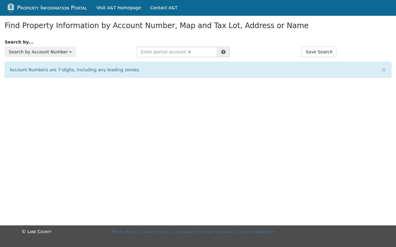
Use the returned Account Number, Map and Tax Lot, Tax Payer, Owner, and Situs Address as the documented starting fields. A result does not disclose a telephone number or establish occupancy.
Map Lane County Streets by Tax Lot
The map step makes the address trail more reliable. The county Map Gallery links to Easy Property Information Lookup, property-sales material, zoning and plan maps, floodplain and wetland information, district locators, and other viewers. For a Lane County street directory search, pan to the address after matching the account or map/tax-lot number, then select the parcel before comparing surrounding lots. The County’s sources describe map results as geographic and planning context, rather than a surveyed property-line opinion.
Within Eugene, Property Explorer can add secondary house-number, recorded-plat, zoning, flood, aerial, historic, and recognized neighborhood-association layers. It is a useful address-checking companion, but the city also says that its map is informational and not survey quality. A map can show which tax lot sits alongside a road. It cannot identify every resident of every structure on that lot.
The RLID Property Research and Reporting Tool displays its public entry routes for Account Number, Site Address, and Map & Taxlot.
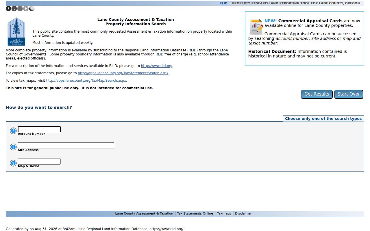
RLID is most useful here as a property and map bridge. Its owner information is updated daily according to training material, but historical information can require confirmation from the library or custodian.
Note: Match the parcel before comparing street-adjacent records, especially where a mailing address and situs address differ.
Follow Lane County Deeds by Address
Lane County Deeds & Records is the continuity leg of a street search. Capture the legal description from the property record when it is supplied, then find the newest conveyance. A legal description identifies land by lot, block, subdivision, or metes and bounds. It is stronger than a modern street address when road names, routing, or house numbers change. The newest instrument identifies the recorded grantor and grantee, a recording reference, and the description needed to test whether an earlier deed involves the same place.
The public research library at 125 E. 8th Ave. is the documented offline bridge. It has grantor/grantee microfilm for 1902 through 1970, grantee and grantor microfiche for 1971 through 1979, separate grantee/grantor microfiche for 1980 through 1998, recorded-document microfilm, and deed microfilm reaching 1854. Public terminals, a subscription RLID route, and phone or mail copy requests are separate access channels. Call 541-682-3654 for copies by email or mail rather than assuming a no-cost online image exists for every year.
A grantor is the party transferring an interest; a grantee is the party receiving it. Start with a known current owner, find that owner’s purchase, then use the prior seller’s earlier acquisition to continue backward. Each step must match the legal description, not merely a familiar street name. The chain documents ownership changes and does not create a list of past or present occupants.
Search Eugene Street Permit Records
Eugene provides a separate address-keyed layer for streets within the city. The online permit system covers permits applied for on or after June 3, 1998. Its Street Address mode uses a number, direction, street name, and street type, with number and street name required. The city specifically permits house number 0 plus a street name when checking all properties on a street. Other modes search permit number, person or business name, contractor, project, map and tax lot, date range, and permit status.
The Eugene Permit Record Search shows the mode-specific search choices for a street, project, or map and tax lot.
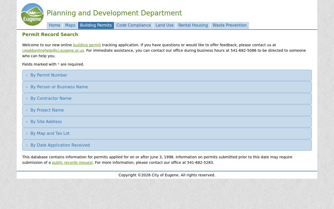
Results can provide a log number, received date, name, site address, scope of work, and map/tax lot, and can be sorted or exported as CSV. An applicant or contractor is tied to a permit record, not necessarily to residence at the site.
For inspection and permit information before June 1998, the city directs requesters to an address-specific request, one address per request. The published estimate allows up to ten business days. This is a practical fallback when an older street trail has no online permit result.
Read Historic Lane County Street Listings
Historical listings add a dated household clue after the parcel and title work are in hand. Eugene’s official historic bibliography identifies Korstad’s Eugene-Lane County Oregon Directory from 1934, Salisbury’s Eugene-Springfield-Cottage Grove & Lane County Directory from 1945, Johnson’s Eugene City Directory in selected years from 1936 through 1965, and a 1945/46 telephone directory. The bibliography proves those editions existed. It does not prove that every edition is currently on a public shelf or online.
Ask Eugene Public Library, University of Oregon Special Collections, or the Lane County History Museum about a specific title before relying on it. When a reverse or criss-cross edition is available, its address section can identify the directory-listed occupant at that date. Compare that entry with an alphabetical edition, deed or tax material, census context, and a newspaper source. The historical collections themselves are described in the Lane County city directories.
- Parcel
- A defined piece of land used in county assessment and map records.
- Situs address
- The physical location assigned to a parcel, distinct from the address where tax notices are mailed.
- Plat
- A recorded map that lays out lots, blocks, subdivisions, roads, or related land divisions.
- Criss-cross directory
- An address-arranged directory, when a verified edition exists, that can show a listing for a particular year.
Compare Lane County Street Record Sources
Each address-keyed source has a narrow role. Joining them through the account number, map and tax lot, legal description, and date gives a more dependable Lane County street directory result than treating one screen as a complete people list. The table separates an owner-of-record trail from permits, maps, and civic data that have different coverage and privacy limits.
| Address record | Lane custodian | Safe reading | Access channel |
|---|---|---|---|
| Current property account | Assessment & Taxation | Account, owner of record, situs and mailing-address distinction | County portal, RLID, or counter. |
| Parcel and GIS layers | Lane GIS, RLID, Eugene Property Explorer | Tax-lot and planning geography | Map Gallery and related viewers. |
| Recorded conveyance or plat | Deeds & Records | Parties, recording reference, legal description | Research library, copy request, or RLID subscription. |
| Eugene permit | City Planning and Development | Project and application history at an address | Online from June 1998; address-specific request earlier. |
| Voter-list request | Oregon Elections / Lane Elections | Limited civic-registration data subject to exemption | Request-based, not public street browsing. |
Surveyor’s Images & Documents Online is another Lane County route for plats, road maps, donation-land claims, road-naming files, subdivisions, and related material described from about 1851 forward. It can help resolve a land identity where a deed drops the current address.
Lane County Street Voter Limits
Oregon My Vote is for an individual’s own registration information and uses name and date of birth, with a security challenge documented during research. It is not a Lane County street directory or a public map of registered voters. A broader electronic voter list is obtained through the state request process, and a less-than-statewide electronic request has a stated setup charge and per-record charge. Lane Elections handles county list formats and fees after it receives its Data Request Form.
ORS 247.948 permits specified voter-list fields subject to exemptions, including party affiliation, birth year, precinct or split, administrative number, phone number, prior-election participation, and some address information. It does not make full date of birth, Social Security number, driver-license number, signatures, disability information, ballot choices, or protected voter data public. A mailing address may differ from the residence address, so it should not be used to infer an entire household.
Address protection matters. Oregon’s Address Confidentiality Program and voter exemption form SEL 550 protect qualifying people and information. A redaction or no-result is not a reason to look for the address through another channel.
Keep Lane County Street Names in Context
Older Lane County records can describe a property without its modern street number. The Archives inventory preserves Alpha Road Index records tied to road names, viewers’ reports, ordinances, plats, and field notes from about 1854 through 1980, along with county road indexes and maps. The county’s territorial boundary changes in 1852 through 1854 add another historical check for early files. Legal description, subdivision or plat, map and tax lot, and the road-name record create a stronger continuity test than a simple address match.
Eugene’s historic residential guidance supplies a local example of why that matters. The first town plat dates to 1851, then large donation-land claims were subdivided. Rail access and a 1909 through 1912 building boom brought new additions and bungalow tracts. Those facts can help date the development pattern around an address. They do not identify a person or prove that a current address always used the same number.
Note: For an older Lane County road, preserve the recorded land description before treating a familiar street name as conclusive.
Respect Lane County Street Directory Limits
A property account can identify an owner of record and a tax mailing contact. It cannot list non-owner occupants, every household member, utility customers, or protected residents. Deeds track title interests, permits track a project or application, and a historic directory records what its publisher listed at a particular time. None of those sources should be presented as proof that a named person currently lives at a Lane County address.
Oregon protects personal DMV information, protected voter information, Address Confidentiality Program data, restricted vital records, and sealed or confidential court material. Oregon stalking and harassment laws also make the boundary practical: public records are not permission to track, threaten, or intimidate another person. When a source is restricted, respect the restriction instead of trying to reconstruct it from fragments.
Lawful use. Lane County street records support personal, civic, and historical research. Do not use an address trail to stalk, harass, or harm anyone.